“Planung ist die halbe Miete” – a German saying that emphasizes the value of preparation and organisation. While there’s no direct English equivalent, a fitting interpretation would be: “Preparation is key.”
For me, good planning is the very foundation of being able to truly “go with the flow.” Because how do I reach that often-mentioned flow state while hiking? By not having to think. My mind is free from questions like: Where do I turn next? Where’s the next grocery store? When does the next ferry leave?
I’ve taken care of all of that in advance. Which makes it all the more satisfying when familiar-looking crossroads, villages or stores appear along the way. Solid preparation allows me to fully focus on the trail and simply follow the signs with the official route logo. On well-maintained paths, these signs appear at regular, visible intervals – like trusted companions guiding your journey.
That leaves room in my head – for new thoughts, creativity, and a sense of calm.
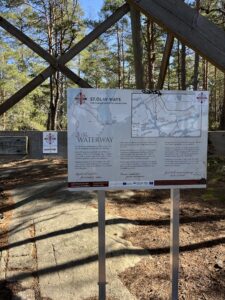
 There are many ways to Trondheim – but only one that winds its way across a chain of islands in the Baltic Sea. Sounds like a planning challenge? Maybe more so than an all-inclusive holiday.
But don’t worry – with some hands-on experience and practical insights, preparing for this route is easier than you might expect.
Here’s my personal Waterway Guide. I’ll walk you through the stages I took from Turku to Mariehamn – and share some alternative routes and accommodations worth considering along the way.
First things first: How to get to Turku?
- By plane to Turku airport (ex. from Stockholm or Helsinki)
- by bus or train from Helsinki airport (takes just 2 hours with either train or bus)
- by passenger ship from Sweden (Viking Line, Tallink Silja Line)
[for more details, check Getting to and from St. Olav Waterway | St Olav Waterway]
Where to stay in Turku?
Arriving in Turku on a Sunday afternoon, I stayed in an accommodation on an old cruise boat hostel S/S Bore Laivahostel Accommodation – Turun ammatti-instituutti, reminding me to the cabins on the ferries that go between Sweden and Finland (meaning, simple and effective).
Other options for accommodations in Turku:
- Birgittalaissisarten vieraskoti (The Bridgettine Convent and Guest House)
- Kokoushotelli Linnasmäki (Hotel Linnasmäki – Turku – Conference hotel, Hotel & Hostel)
- several other accommodations in the city center of Turku
Day 1: Turku – Kirjala (22 km)
The first hiking day started just as it should: with a breakfast buffet. I even got to enjoy my all-time favourite – Karjalanpiirakat, Karelian pie with egg butter!
From the boat hotel, it’s about a 45-minute walk (around 3 km) to Turku Cathedral, where you can visit the Pilgrimage Centre and “officially” begin your hike along the St. Olav Waterway.
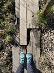
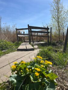
The route leads you out of the urban center of Turku and into the scenic Katariinanlaakso Nature Reserve (Catherine’s Valley), located in the city’s southern suburbs. You’ll walk across wooden planks through swampy terrain, follow quiet forest trails, and stroll along the coastline near the town of Kaarina. Eventually, you’ll reach the first major bridge, which takes you onto the first island of the archipelago.
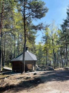
Just across the bridge, you’ll find a K-Supermarket — a great spot to rest, grab some food, and recharge (both yourself and your devices, if needed).
From there, the trail follows the main road across the islands and over another bridge leading into the municipality of Pargas. Although the route runs parallel to a fairly busy road at this point, pedestrians have a separate walking path, allowing for a relaxed and safe walk with views of both forest and fields along the way.
Where I stayed: Waudevilla – a cosy accommodation located directly on the pilgrimage route, offering breakfast and dinner on request.
 Optional:
You can also walk the full stretch to Pargas town (approx. 30 km total) but remember — it’s only day one of your Waterway journey. Pace yourself and manage your energy wisely.
Day 2: Kirjala – Pargas (8 km)
On the second day, I completed the rest of Stage 1 (see Outdooractive map below) and walked to the charming archipelago town of Pargas (Parainen). It’s a short and relaxed stage, making it a great opportunity to enjoy the journey.
The path follows the main road across the island, and there’s currently construction work in several areas. While this section may not offer the same peaceful scenery as other parts of the route, there is a separate pedestrian path for most of the way.
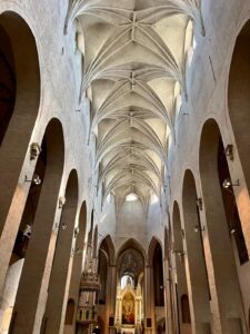
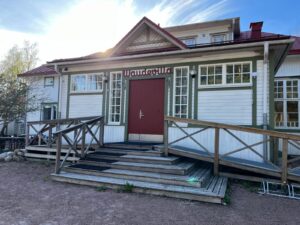
Once in Pargas, it’s worth taking some time to explore: visit the medieval stone church (don’t forget to get your pilgrim stamp!), wander through the picturesque old town, enjoy the summer vibe at the beach, and treat yourself to one of the small coffee shops in the city’s “shopping” street. The relaxed coastal atmosphere here makes it easy to recharge.
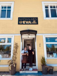 Where I stayed: Matmalmen @Eva – Eva is a warm and welcoming host who has created a cozy, inviting space — and she’s also a fantastic cook, serving up delicious meals made from fresh, local ingredients.
Alternative accommodations:
Hotell Kalkstrand (Strandbo Group – Saaristoelämyksiä ympäri vuoden)
Solliden Camping (Contact Us – Solliden Camping)
Day 3: Pargas – Lillandet (25 km)
Day 3 begins with the option of a stroll through the historical district of Gamla Malmen in Pargas — a quiet area of old wooden houses and cobbled streets. If you didn’t explore it the day before, this is a great chance to do so before heading out.
After around 10 km, it’s well worth taking a break at Sattmark Kaffe & Safka, a lovely summer café located just after a bridge and directly along the trail. From here, you can walk down to the sea and even take a quick dip at the small beach — a refreshing pause before continuing on.
The trail then leads to the ferry from Pargas to Nagu (Nauvo). These free ferries run roughly every 15 minutes and don’t require booking. Pedestrians and cyclists are always guaranteed a spot, so you can simply walk aboard and enjoy the short crossing.
Find the ferry schedule here: saaristotien-lautta-aikataulut-1.5.2025-30.4.2026.pdf
Once you land on Nagu, be mindful that the road across the island doesn’t have a separate sidewalk — and cars often come in waves due to the ferry schedule. Stay alert and walk along the roadside with care.
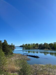
That said, the walk through Nagu is otherwise peaceful and scenic, with sea view, quiet forests, and open countryside. The terrain is relatively flat and easy to manage, making this an enjoyable stage.
 Where I stayed: OakTree B&B and Café – A one-of-a-kind place in the Nagu countryside. Eliisa and Tero bring a lively, welcoming energy to this beautiful oasis. The sunny wooden terrace is the heart of it all — perfect for relaxing, chatting, or simply enjoying the atmosphere. The rooms are cozy, the food is homemade, and Eliisa is always up for a warm conversation.
Alternative accommodations:
Villa Vintage (Villa Vintage B&B)
Gyttja Västergårds Gyttja Västergårds, Nagu (uppdaterade priser för 2025)
Day 4: Lillandet – Nagu City (14 km)
The day starts with a real treat: the homemade breakfast buffet at Oak Tree B&B, featuring fresh-baked bread, pancakes, vegan options, and specialty coffee — the kind of breakfast that makes it hard to leave.
Once on the trail, the route leaves the archipelago’s main road and leads toward the sea — about 4 km from Oak Tree to the shoreline. This stretch is especially pleasant: it follows quiet, smaller roads with charming views of the sea, making for a peaceful and scenic walk.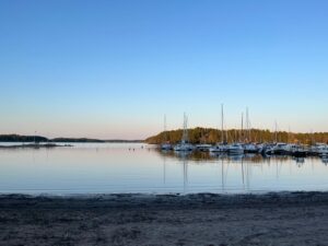
Eventually, the path rejoins the main road for the final approach to Nagu City. The atmosphere here shifts noticeably — vibrant, summery, and full of life. Sometimes called “Finland’s St. Tropez”, Nagu’s harbor town offers restaurants, cafés, and a holiday feel that contrasts nicely with the quieter stretches of the walk.
 Where I stayed: Lanterna Hotel | Hotell i Nagu | Hotelli – Nauvo | Boka här – A small and charming hotel right in the heart of Nagu. The location is ideal, with everything in walking distance — and the beach is just a 5-minute walk away.
Alternative accommodations:
Köpmans Café & Restaurant, Bed & Breakfast (Bed & Breakfast Majoitus Köpmans Nauvo Hotelli Hotel Ravintola Kahvila)
Hotell Strandbo (Strandbo Group – Saaristoelämyksiä ympäri vuoden)
Day 5: Nagu Village – Korpo (24 km)
This stage offers a real treat for those who enjoy walking away from traffic: you can follow a mostly off-road route across Nagu, covering around 22 km on peaceful trails and quiet side roads before reaching the ferry to Korpo (Korppoo). It’s a more scenic and enjoyable option than the shorter main road route, which is possible — but not recommended.
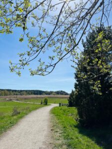
The off-road path leads through forests, open countryside, and the occasional seaside stretch. It’s one of the more tranquil stages of the Waterway, allowing you to settle into your pace and take in the natural surroundings without much distraction.
 After 22 km, you reach the free ferry to Korpo — no booking needed, and as always, foot passengers are guaranteed a spot. Once you’ve crossed over, there are about 2 more kilometers to walk along the main road on Korpo before turning right onto a quiet sand path.
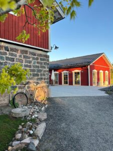
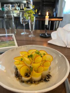
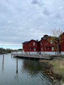
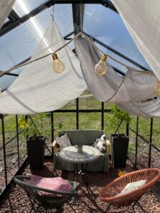
This final stretch is pure magic. The landscape feels like something between Bullerbü and a storybook wedding venue — peaceful and charming in an almost unreal way. The path leads you to a very special place: a fine-dining restaurant set in a laid-back countryside setting. The Hotel Nestor and Restaurant Backpocket offers a surprising combination of rustic calm and creative culinary art — a kind of effortless perfection that makes for a memorable end to the day.
Where I stayed (& dined): Hotel Nestor and Restaurant Backpocket (We welcome you to Hotel Nestor and Restaurant Back Pocket) – A surprising combination of countryside simplicity and artful cuisine.
Alternative accommodations:
- Faffa’s B&B (Faffas)
- Airbnb Arvids (Arvids – Villas for Rent in Korpo, Finland – Airbnb)
- Naawa Nature Awakening (Naawa Nature • Accommodation in tentsiles, Amok hammock and camping spots)
- Solvillan Guesthouse (Solvillan – Retro B&B in Korpo)
- Hjalmars´Restaurant and Pub (Hotel — Hjalmars)
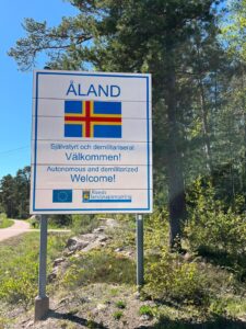
Day 6: Korpo – Kökar (Åland Islands)
This day is all about the crossing from mainland Finland to the Åland Islands — a slower-paced but noteable transition as you journey further out into the archipelago.
From Hotel Nestor, it’s about 5 km to the Galtby Ferry Terminal. If you have time in the morning, there’s an option to take a detour into Korpo’s small town center and walk part of the way back (an 11 km round-trip). Just make sure to keep an eye on the time, as the ferry to Kökar only runs once in the morning and once in the afternoon.
- Ferry departure: Galtby – Kökar
⏱️ 10:00 – 12:30 / 15:15 – 17:35
Check the ferry schedule for updated information about the ferry times: 17.4-sodra.pdf
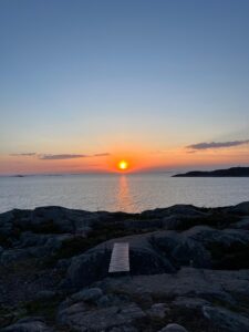
The ferry crossing is scenic and relaxing — a chance to rest your legs and take in the island-dotted seascape. Kökar is your first stop in the Åland Islands, and it already feels noticeably different: wilder, windier, and at the same time quieter.
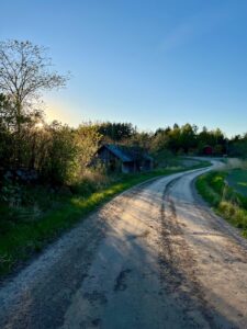
Once at the harbor in Kökar, it’s still light out, and the 3.5 km walk (approx. 45 minutes) to Karlby (heart of Kökar) is easy to manage and a fantastic evening walk along red roads.
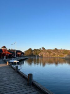 Where I stayed: Hotell Brudhäll | Kökar – The hotel is nestled in a picturesque setting about 3.5 km from the ferry port. Upon arriving at Brudhäll, time seems to slow down – you can savor a fresh archipelago meal, relax on the terrace overlooking the guest harbor, and unwind in the sauna (a must on a hiking trail in Finland!).
Alternative accommodations:
Sandvik Gästhamn & Camping (Sandvik Gästhamn & Camping)
Antons Gästhem (About Antons)
Day 7 (optional rest day on Kökar 5-8 km)
After several days of walking, Kökar is the perfect place to slow down — or, if you’re feeling active, to explore at your own pace. Bike rentals are also available at Brudhäll – not just for the eager adventurers, but for anyone wanting to experience the true charm of the archipelago.
You can spend the day walking a gentle 5–8 km loop around the island, taking in rugged coastline, quiet forests, and the ruins of the Franciscan monastery — a serene and historical spot with beautiful sea views.
Alternatively (or additionally), you might opt for something special:
A sailing trip with the traditional boat “Tjutt-Tjutt” — a unique way to see Kökar from the water. It’s an unforgettable experience that gives you a real sense of life in the archipelago. (Book in advance by email)
Whether you’re hiking, sailing, or just soaking up the peace of the Åland air, Kökar offers space to breathe, reflect, and recharge.

Day 8: Kökar – Lumparland (13.5 km)
 Starting into the morning on Kökar with a walk from your accommodation to the ferry terminal.
- Ferry: Kökar → Långnäs
⏱️ 06:30 – 09:00 / 09:15 – 11:50 / 15:00 – 17:25
This scenic crossing brings you deeper into the heart of the Åland Islands, with plenty of time to relax, enjoy the views, and perhaps chat with other travelers on board
Anecdote: On one ferry ride, I met Aini and her young son, Alf. We had a lovely conversation during the crossing, and I ended up helping keep little Alf entertained for the several hours we spent on board. To my surprise and delight, Aini later invited me to visit their home on Kökar. I took her up on the offer the next day – and was deeply touched by the warmth of their welcome. It was a beautiful introduction to the island’s generous spirit.
Once arrived at Långnäs, there’s about 10 km left to walk to the next stay. The route to Amalia’s leads through rural Åland landscapes — quiet roads, open fields, and the occasional glimpse of the sea. It’s a peaceful stretch that gently eases you into the rhythm of mainland Åland.
 Where I stayed: Amalia’s Bed & Breakfast (Hem | Amalia) – A cosy countryside stay with homemade charm (and lemonade!). It’s a calm, welcoming place to rest after the day’s travels — and a great base for the next stage of your walk across Åland.
Alternative accommodations:
Svinö Stugby (Svinö Stugby Villas & Stugor – Upplev våra aktiviter som fiske jakt boende gocart paintball golf cykel tur naturen bad)
[Find the outdooractive map for the Åland Islands above - Day 6 Korpo to Kökar]
Day 9 (Lumparland – Lemland, Åland Islands, 12 or 22 km)
Alright, I’ll admit it – on day 9, I made a small change to my original plan. Instead of continuing all the way to Lemböte Lagergård as intended, I decided to stay at Villa Valentina instead. It turned out to be one of those spontaneous choices that make a journey even more memorable…
Anecdote:
After walking for more than two hours across Lumparland – following the “Lemlandstigen” trail through
forests, fields, and rocky stretches – I finally reached the small village of Lemland. It was a hot day, and my energy had been steadily fading. I was craving a good coffee or just a place to rest and recharge. But in this quiet village on a remote island chain, the only visible options seemed to be a small local supermarket and a Thai restaurant.
What more could I expect in such a secluded spot? Certainly not a café and B&B with the charm of Tuscany – serving fresh Italian coffee, inviting me to relax in a beautiful greenhouse, and even offering a place to stay the night. But that’s exactly what I found!
I met Valentina and Naemi at their garden fence, and without hesitation, they invited me in for coffee. It was one of those rare, serendipitous moments that make travel so unforgettable.
 Where I stayed: Villa Valentina (Villa Valentina, Lemland (vuoden 2025 päivitetyt hinnat))
Alternative accommodations:
Lemböte Lägergård (Lemböte lägergård – Mariehamns församling)
Day 10: Lemland – Mariehamn (20–30 km)
Start your day right with a fantastic breakfast – a delicious blend of Italian specialties and fresh Åland ingredients. It’s the perfect fuel for today’s scenic journey.
 While the main road offers a more direct route to Mariehamn, I highly recommend taking the more peaceful and picturesque seaside path. This alternative route allows you to walk along the water’s edge, enjoying open views, fresh sea air, and a much more pleasant hiking experience.
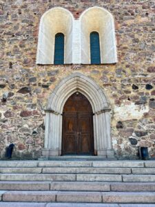
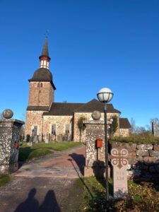
The Church of St. Olav in Jomala is located around 20 km from Lemland and marks a fitting milestone on your final day of the St. Olav Waterway. As one of the oldest stone churches in all of Finland, and dedicated to St. Olav himself, it’s a meaningful place to pause, reflect, and perhaps quietly celebrate the journey.
From there, it’s another 10 km to reach the heart of Mariehamn, the lively marine capital of the Åland Islands.
 If you’d prefer a shorter walking day, you can head straight to Mariehamn and visit the St. Olav’s Church the next day – it’s easily accessible by bike or local transport.
Accommodation options in Mariehamn range from guesthouses to hotels and campsites. I chose to stay at Övernäsgården Stugor och Gästhem – Home and spent the night in one of their small, comfortable cabins.
Find more options for accommodations along the Waterway here: Majoitus /Accommodation /Boende Åland – St. Olav Waterway – Google My Maps
From Mariehamn by passenger ship to…
… Sweden (Stockholm, Kapellskär or Visby on Gotland)
… Finland (Helsinki or Turku)
… Estonia (Tallinn)
[For more information, check the websites of Viking Line, Tallink Silja Line and Finnlines.]
Useful links
Understanding and finsing updated ferry times: Saaristolautat.fi
Discover the archipelago with all its accommodations, activities and services: Home – Visit Parainen
To be up to date about all happenings, events and activities visit: Event Calendar | Archipelago Town Pargas
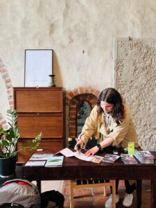
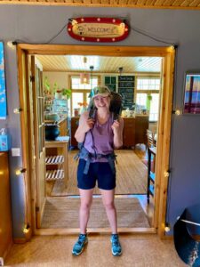
About the Author
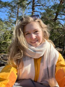
My name is Leonie, and in May 2024, I walked the St. Olav Waterway as part of my internship at the Nidaros Pilegrimsgård in Trondheim, Norway. Today, I live and work in Turku, Finland—so I’ve gone from the destination of the St. Olav Ways to one of their starting points in Finland.Originally from Berlin, Germany, I hold a Bachelor’s degree in Sustainable Economy and Management. I’m passionate about sustainable ways of traveling, slow living, and spending time outdoors—and I believe that walking is one of the most meaningful ways to connect with people, places, and nature.