Maps
What do you prefer: hiking, cycling, kayaking or sailing?
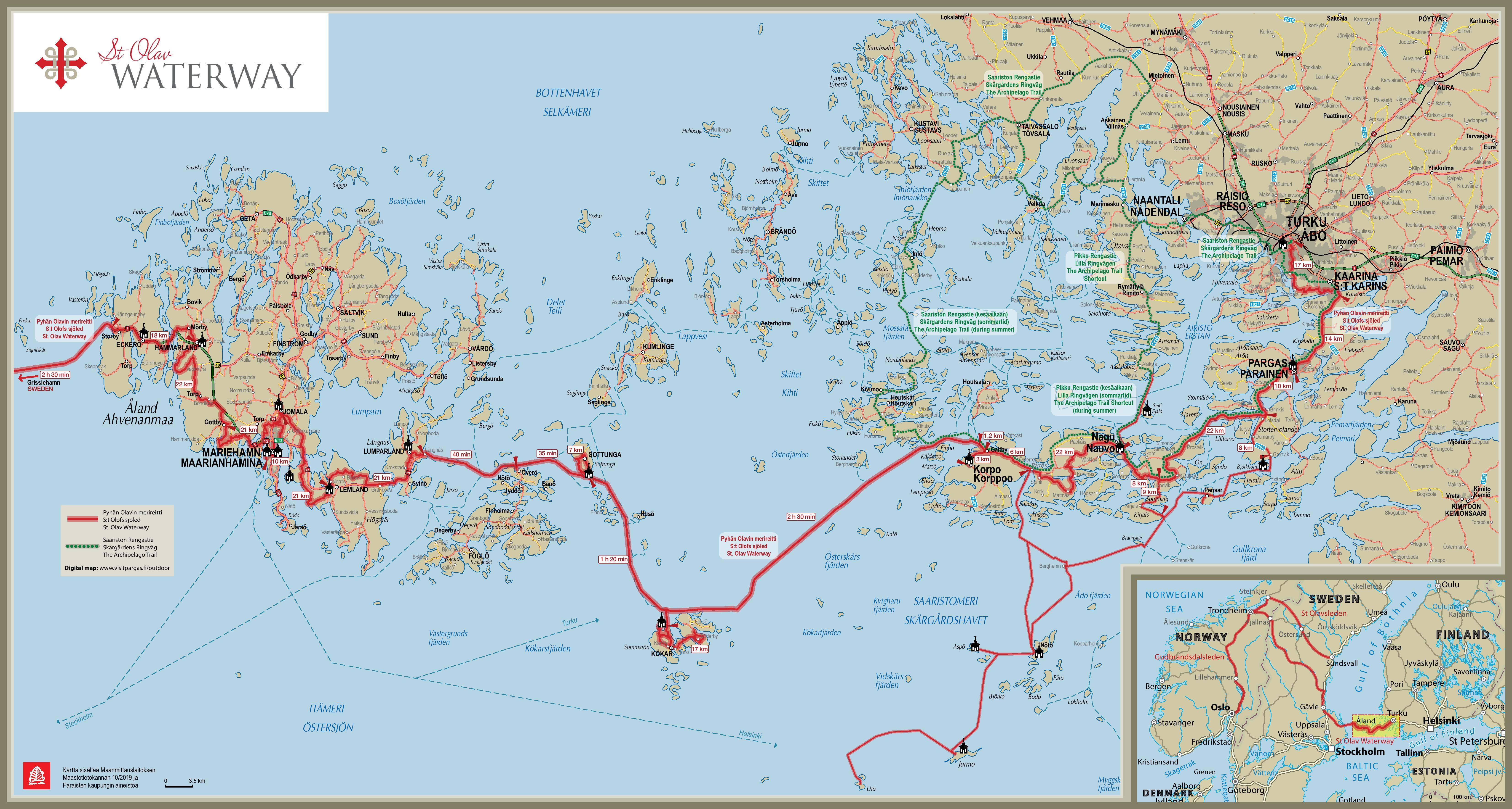
Find a detailed six stage description of the route here (also seen in the maps below):
- Route descriptions, ferry timetables and places to stay are linked from the individual stages.
- The maps are downloadable and printable.
- A GPX or KML track for navigation can be downloaded to your phone, GPS, smartwatch or sports-tracker.
- For mobile navigation and planning on your phone, we recommend the free Outdoor Active app.
In order to prepare for your trip, why not explore the trail and landscapes on Google “hike view” with 360 degree pictures, the trail is also available on google maps as streetview.
Additional information:
Accommodation map: Majoitus /Accommodation /Boende Åland – St. Olav Waterway – Google My Maps
Cyclists have a dedicated map and GPX track of the route.
Map of ferry connections (in the area of the Archipelago trail): Saaristolautat.fi
The network of St. Olav Ways as an official European Cultural Route: St. Olav Ways official routes – ACSOW
Continue walking along St. Olav Ways from Selånger – Trondheim: St Olovsleden
Pilgrim paths continuing in Sweden: pilgrimsleder2018-korr3
- Vikingaleden: Grisslehamn-Harg Visit Roslagen
- Helgonleden: Uppsala-Trondheim Laps and maps in details
- Stråsjöleden: From Korsholmen to Jämtland where it connects to Helgonleden Laps and maps in details